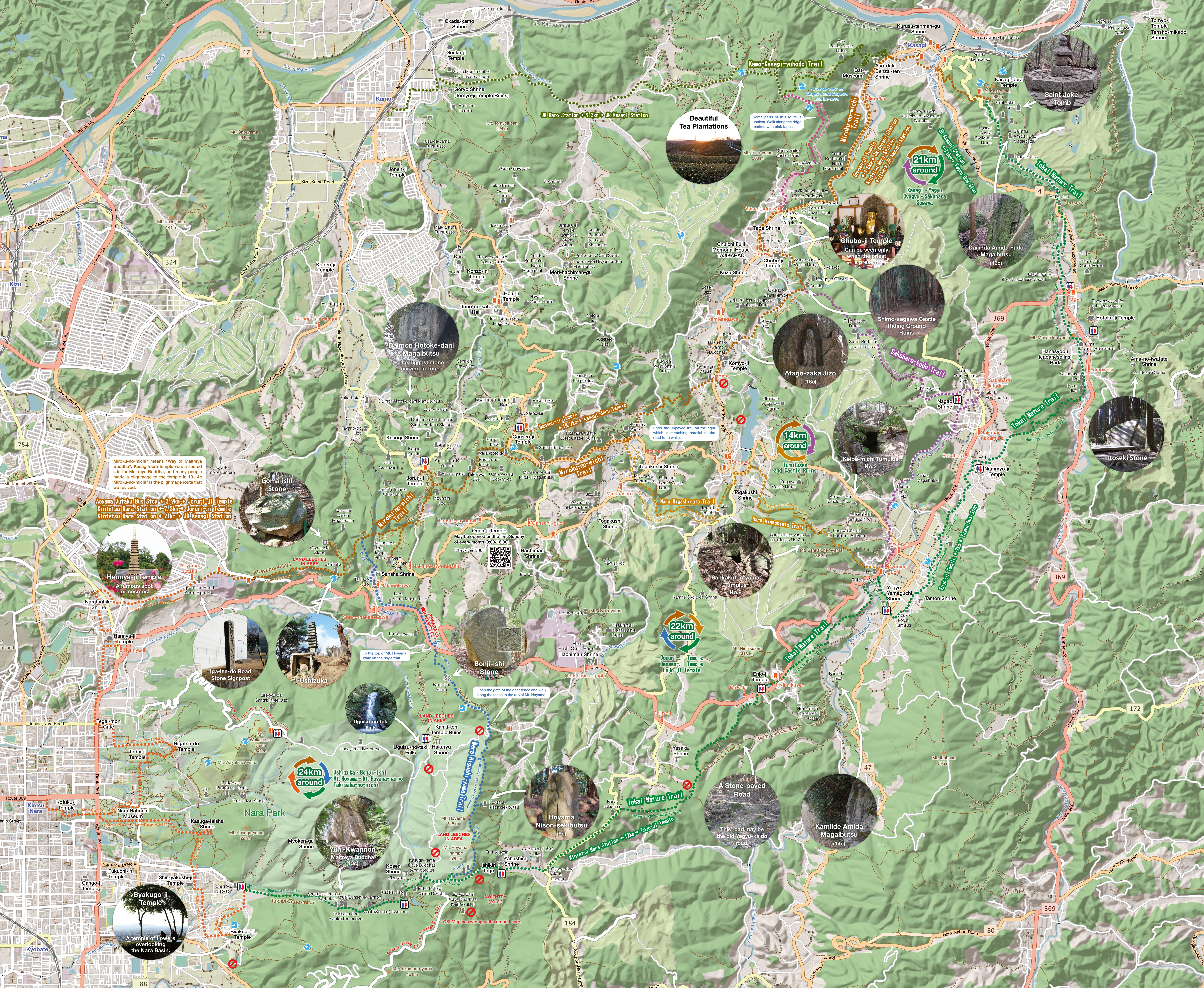
This map is based on the
Open Street Map and overlaid with the GSI's hill-shading map. Access the
Open Street Map and a more detailed map will be displayed in your browser. You can also display your current location. The distances shown are from
GraphHopper for your convenience.
Let's maintain historical footpaths by ourselves!
Most of mountain trails on this map are
municipal city roads owned by the city, that has been maintained by local people voluntary. However, due to depopulation and other factors, not all trails can be maintained well. If you find rough condition because of fallen trees or weeds, you are welcome to remove them.
Anyone can maintain city roads without a permit.


